8.6.2020 | Logbook
Author
Reza Naderpour
WSL postdoc Reza Naderpour experiences how challenging planning for an expedition like MOSAiC is. To begin with, the trip to and from Polarstern lasts three months longer than expected. Then dynamic ice make his measurements extremely difficult. But good team spirit and a successful scientific mission make up for all of this.
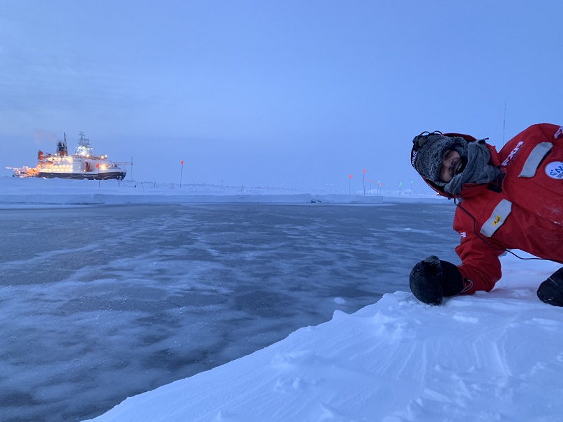
If one asks me how long I stayed on the MOSAiC floe, my answer will probably be “14 nights and then a very long day!” When we arrived to Polarstern for Leg 3 of the expedition the differences between dawn and light were starting to fade, and then the sun stopped setting.
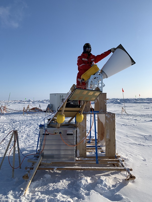
ELBARA Radiometer scraping past the abyss
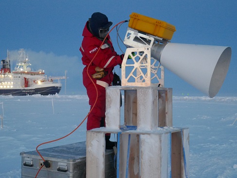
One of the key focus points of MOSAiC research is microwave remote sensing of sea ice and its snow cover to improve the models utilized for the estimation of sea ice properties from satellite measurements. To do this, several active (such as radars operating at L-, C, X-, and K-band) and passive instruments (such as ELBARA, HUTRAD, SSMI, and GNSS-R) are used to measure the microwave signatures of sea ice in different conditions. These remote sensing measurements are accompanied by other in-situ measurements of snow and ice such as density, thickness, temperature, and salinity. My part of the project was to operate an ELBARA radiometer which we had previously sent to the ship.
Leg 3 measurements were truly unique in their nature as they covered the most extreme weather and ice dynamics conditions recorded during MOSAiC. One notable extreme set was the air temperature variations with values as low as -42°C in the first few weeks of March and as high as 0.7 °C in mid-April. This allowed us to capture the microwave emission of sea ice and snow in Arctic winter conditions as well as recording partial snow melt which is unusual for the Central Arctic during April.
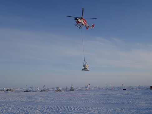
However, the great dataset did not come for free. One day the ice cracked open around our observation site and we had to rush to save our equipment. Relocating the installation was a major logistical operation involving sleds, skidoos and helicopters and lasted a full week. Such experiences made me realize the cost and effort needed to gather our data. At the same time, working together so intensively made a family out of individual team members.

Image 1 of 7
The ice cracked open next to our remote sensing site.

Image 2 of 7
With the support of a helicopter we moved our instruments away from the crack.

Image 3 of 7
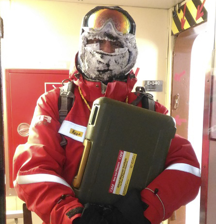
That's what I look like after working outside for several hours at -40 °C. Notice the heatpads I had do apply to prevent my cheeks from freezing.

Image 4 of 7
After the successful rescue mission I was able to relax for a short moment.

Image 5 of 7
With the new site closer to the ship and on more stable ice we were finally able to collect a lot of data.

Image 6 of 7
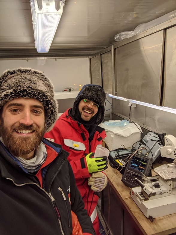
We had a cold lab on the ship, here I conduct sea ice permittivity measurements with Steven Fons from the NASA Goddard Space Flight Center.

Image 7 of 7
Finally there: View from the Bridge of the Kapitan Dranytsin icebreaker that took us to Polarstern.
Successfull data collection at the second attempt
The ELBARA on sled built by Derek Houtz is indeed the Arctic sister of the larger ELBARA installed on the Davos-Laret Remote Sensing Field Laboratory. At the new site we had a great chance of measuring second-year sea ice and to design further experiments to better understand the microwave characteristics of sea ice and its snow cover and spatial variabilities of sea ice. This required moving around our ELBARA and HUTRAD equipment and we learned: You never know how heavy an instrument is unless you try to pull it on sled by hand!
Another experiment involved measuring the dielectric properties of sea ice and saline snow cover using resonator sensors, something that hadn’t been done on Arctic sea ice for forty years. We had used these sensors before in Davos and over the Greenland Ice Sheet and were excited to do it in one of the least accessible areas on this planet. While this is a tedious process which includes sea ice coring, cutting the core and taking range of measurements both on the field and in the cold lab, it is also a great opportunity to bind more with cool colleagues from around the world.
Leg 3 has been exciting, sometimes maybe too exciting, with numerous challenges and surprises. Therefore, our days and weeks had little sense of routine except for the meal times and nice coffee breaks and planning meetings. But it’s not always work. Sometimes we take time to play a game or watch a movie together. We have also had a few very exciting moments when we were visited once by a friendly polar bear and later an arctic fox and of course many birds.
After more than three and a half months of both completely dark and completely bright Arctic, I am counting the days to when I will see some green and some hills and mountains. At the same time I’m aware that processing the information I collected here will require a lot of time and work to turn it into a greater understanding of the sea ice.
Das Remote sensing team at WSL developed the ELBARA Radiometer, using it for long term measurements in Davos. Later a compact version was added for the MOSAiC expedition.
MOSAiC Expedition update
Despite great logistical challenges due to Corona, the MOSAiC expedition continues. On 3 June, Polarstern arrived in the Isfjord in Spitsbergen, where crew and researchers are being exchanged. For this, the research vessels Maria S. Merian and Sonne, which were not involved in other projects due to the Corona crisis, sailed from Bremerhaven to Spitsbergen.
Reza Naderpour will be back from his expedition at the end of June, two months later than planned. SLF researcher (PhD student) Amy Macfarlane is still attached to the expedition, as she is very enthusiastic about the work on the sea ice. Another exchange is planned for early August.