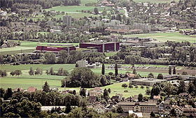
The settlement area is spreading more and more. This increasing urban sprawl in the open landscape has negative impacts on people and nature. We are researching how urban sprawl is developing in Switzerland and how it can be controlled.
Contents

Urban sprawl in Switzerland is increasing - and this clearly contravenes the goal of sustainable spatial development. This problem is now widely recogniszed and the subject of political debate. In order to limit urban sprawl, a comprehensible method of measuring it, reliable bases on its past development and targets for the future are needed. Only targets create legal certainty, put an end to competition between municipalities for jobs and inhabitants, and enable better cooperation for sustainability. In the Bristol Series volume "Zersiedelung essen und begrenzen" we have presented measures and targets for Switzerland, its cantons and municipalities, building on previous research.
Weighted Urban Proliferation
To do this, we worked with the "weighted urban proliferation" measurement method developed in Switzerland. With its help, urban sprawl can be shown spatially explicitly at any desired point in time, so that its development can be recognized. The method measures and "weights" urban sprawl on the basis of three components: the dispersion of settlement, the use of settlement area (land use per person and workplace) and the proportion of settlement area in the observation area. The results show that urban sprawl in Switzerland is still increasing faster than population and jobs . This measure of urban sprawl has also been used internationally in various projects, for example in a report by the European Environment Agency and the FOEN on urban sprawl in Europe (Report No 11/2016).
Sprawl can now be calculated very easily with an additional programme, a plug-in, of the Geographic Information System QGIS . The plug-in was developed by the Institute for Software IFS OST on behalf of the Federal Office for Spatial Development ARE. It outputs the measure of urban sprawl as "Weighted Urban Proliferation" (WUP) and calculates it per observation area (municipality, canton or other spatial division).
The fact that the degree of urban sprawl can now be easily calculated is an important key to ensuring that it is widely taken into account in planning practice in the future. The new metric and calculation tool provide planners with a tool to set targets for the future and to test the success of measures designed to reduce urban sprawl. Since 2022, an international urban sprawl network has been dedicated to these issues and is led by the WSL and the Federal Office for Spatial Development ARE. In the urban sprawl network, representatives from science and practice as well as from the Federal Office for Spatial Development ARE and the Federal Office for the Environment FOEN meet every six months for a virtual exchange. International expertise from Switzerland, Germany and Canada is represented in the network. The aims of the network are to further develop the measure of urban sprawl and the necessary data basis and to promote the use of the urban sprawl measure in spatial planning practice. We are interested in expanding the network and look forward to hearing from you.