
04.08.2025 | Michael Haugeneder | SLF News
Contact 
Three SLF Staff spend two months on the research vessel Polarstern to record various snow data in the Arctic ice. They report on their journey in the logbook blog. Part 2.
This text was automatically translated.

And then the time had finally come: the gangway descends from the ship onto the ice and we step onto the sea ice for the first time on this expedition. Ruzica and Matthias had already been to the polar regions. For me, it's the first time. It's a special feeling when you can simply step off the ship onto the sea. You're walking on ice that's a good one to two meters thick and you can even ride a snowmobile. Underneath is over 4000 meters of ocean. It is not particularly cold. It's around 0° C and there's a light wind. But with our polar suits it is warm enough.
To get to this point, we had already spent a week on board the German research vessel "Polarstern". First we sailed from Tromsø through the Norwegian fjords and then out to sea. After two days at sea, we reached Longyearbyen in Spitsbergen. We only made a short stop there for formalities before heading north. After another day, we arrived at the ice edge. It is very impressive to see the ice for the first time after a few days, where we will be moving for the next eight weeks. The transition from open sea to ice is sharp. Within a few hundred meters, we are already in thin ice floes that cover almost the entire surface.

As planned, we meet the Tara Polar Station right at the edge of the ice. The newly built French ship is reminiscent of a UFO or a space station. The plan is to freeze repeatedly in the Arctic sea ice over the next 20 years and then drift with the ice for over a year while conducting experiments. As the ship is not built for icebreaking but for drifting, it will accompany us several miles into the ice. It sails directly behind the Polarstern and thus uses the free channel to make better progress. The very next day, we leave the Tara Polar Station behind us and continue on our way north.
On the ship, it is very impressive to see how sometimes meter-thick ice floes break under the weight of the hull and are pushed aside. As often as the weather permits - and this is not so common in the Arctic, which is often foggy in summer - the crew carry out reconnaissance flights with the on-board helicopter to find the best route through the ice. Thick ice is often interrupted by channels with open water and sometimes kilometer-long ice-free passages. In addition, daily updated satellite images are available to provide information about the ice distribution and possible routes. It is difficult to predict our arrival at the first measuring position: if the ice is too thick, the ship often has to reverse again to gain momentum, which is sometimes only enough for a few more meters.

After two days of ice-breaking, the time has come. In the morning, the first researchers go out onto the ice and explore the floe. How thick is the ice? Where does it make sense to take which measurements? The 50 or so researchers on board have many different interests and it is important to satisfy as many of them as possible. This is the only way to create a comprehensive data set in the end. For our atmospheric turbulence measurements, it is important that we are at a transition from melt pond to ice and that the wind transports the air from the melt pond over the ice. We try to carry out our surface and snow measurements at as many locations as possible in order to best capture the spatial heterogeneity of the surface scattering layer (SSL), which scatters the incident light and thus determines how light or dark the ice appears, and how much light it reflects (important for melting) or how much light it transmits (important for the marine ecosystem and the CO2 cycle). In addition, paths must be marked so that each Research Groups can work on untouched ice.
After the advance party has explored the floe and the stations and paths have been marked, there is a short meeting for us to explain the division. And then: a polar bear. From the bridge, an attentive observer has spotted a polar bear lying on the ice, about a kilometer away. For the time being, nobody can get onto the ice. After some consultation, the cruise director decides that only three groups are allowed on the ice for the time being. Each group must have a bear guard with them. This is a person who cannot help, but is only there to keep an eye out for polar bears. In addition, the lying bear is constantly monitored. As we want to set up and take down our turbulence measurements and the measurement time is limited, we are allowed to go out first. We make good progress and by the evening the first two turbulence stations are up and measuring.

The very next morning, the bear has moved on and more researchers are allowed onto the ice. Thanks to great support from other teams, the screens for the IR screen setup are up shortly after breakfast and the infrared camera is continuously recording data. As these measurements are now running, we have time to measure the surface scattering layer in as many places as possible. To do this, we take one image at a time with the SnowImager, from which we can then determine the specific surface area and density. We also measure the height of this layer and take pictures of some areas from different angles, which we can later use to reconstruct the surface roughness. In addition to these measurements, we also have time to help other researchers with their work. We are allowed to help take ice cores, which are then analyzed in the ship's own refrigeration laboratory. We also help to deploy a buoy that measures the temperature profile in the ice and in the ocean directly below.

Image 1 of 12
From the open water into the first ice. These rather roundish floes with the protruding edge are also known as pancake ice. (Photo: Michael Haugeneder / SLF)

Image 2 of 12
Meeting point at the ice edge with the Tara polar station. The Tara is a brand-new "ship" that wants to be frozen in the Arctic ice for research purposes in the future. Because it is a "drift vehicle", it cannot break ice itself and therefore follows us a few miles into the ice. (Photo: Michael Haugeneder / SLF)

Image 3 of 12
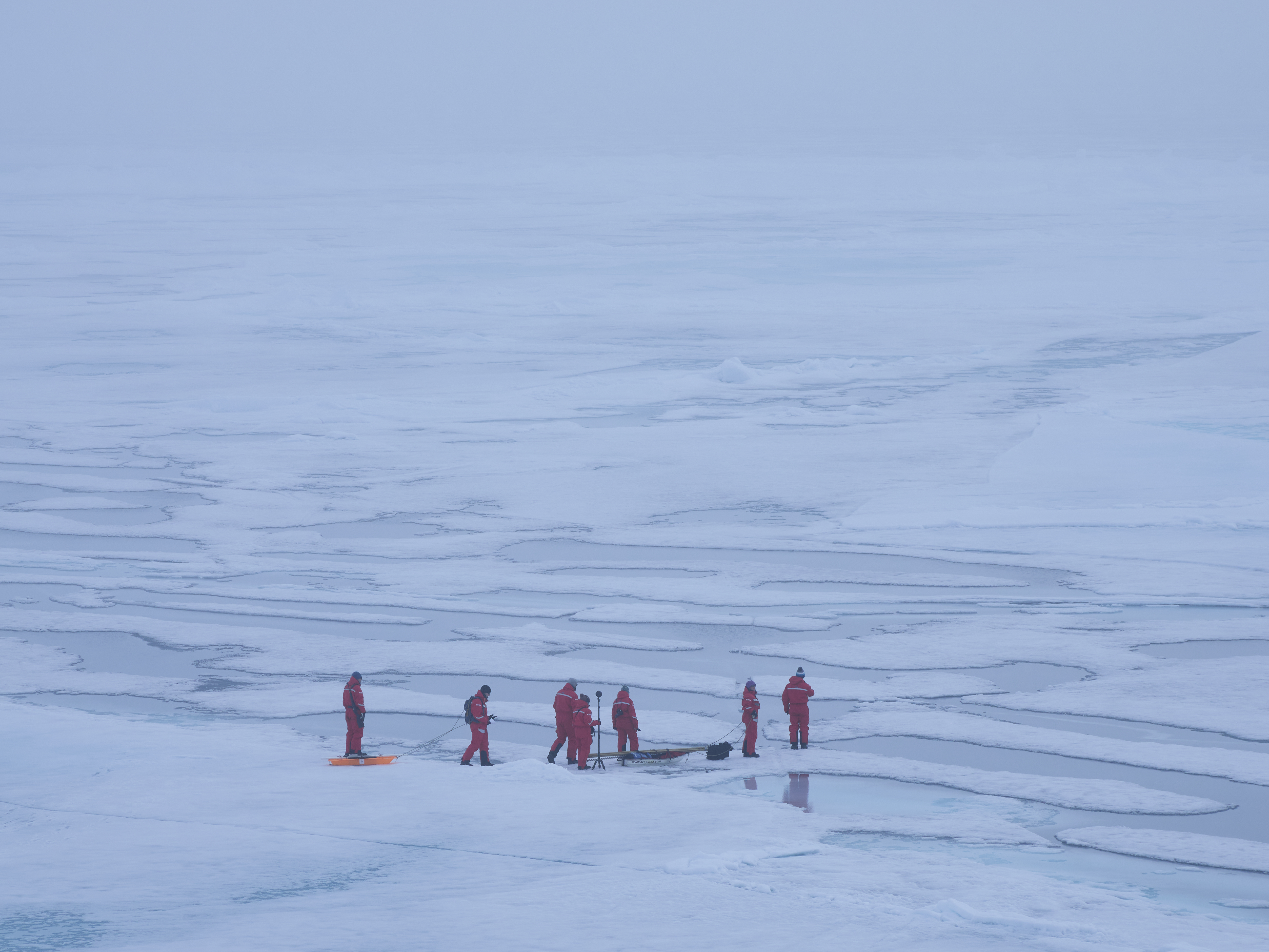
Once we arrive at the chosen floe, the expedition leader explores the surroundings and defines the various measuring fields. The walking and driving paths are marked out with flags so that we researchers don't accidentally trample or contaminate things that we want to sample later. (Photo: Matthias Jaggi / SLF)

Image 4 of 12
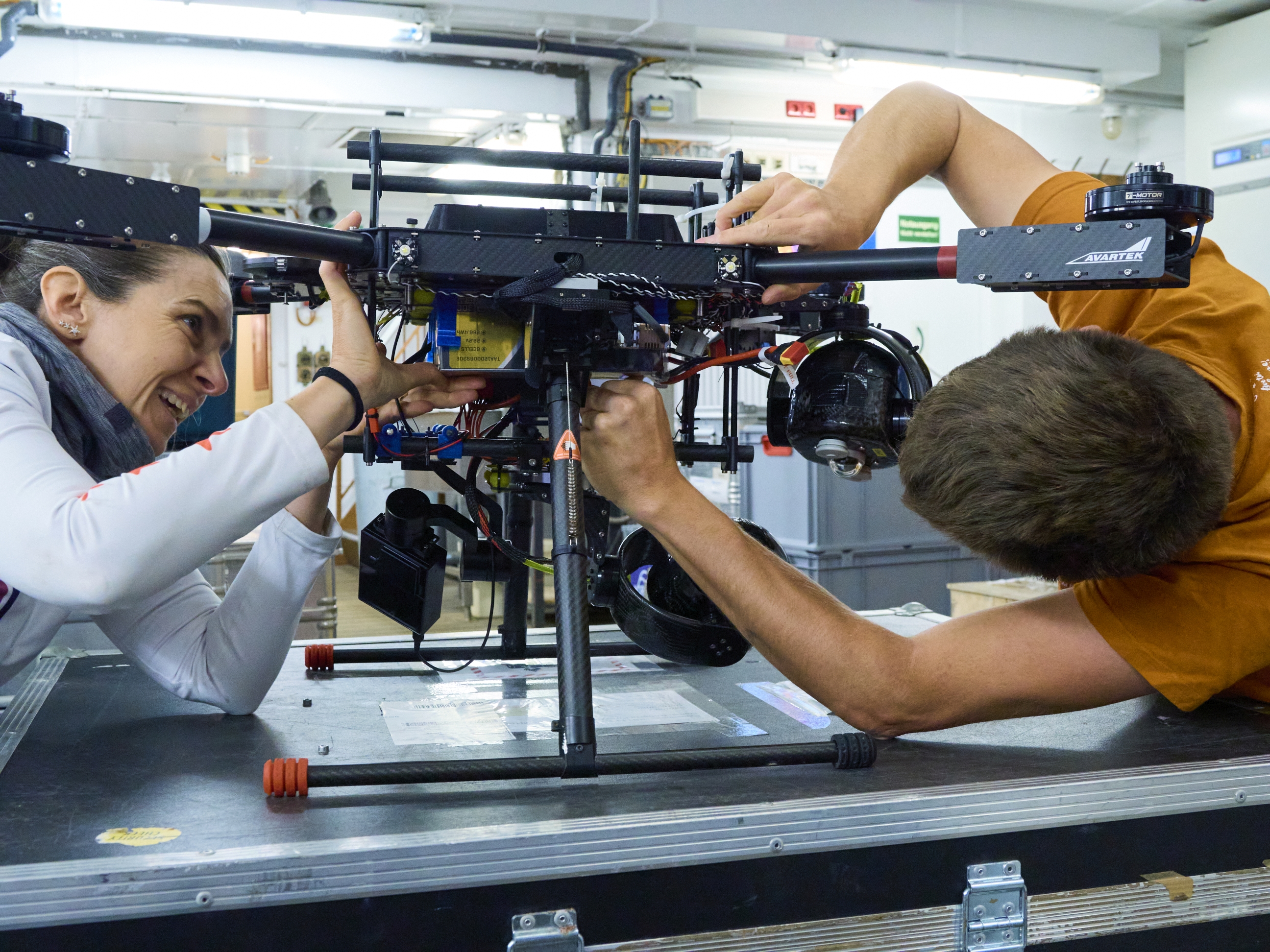
Preparing and testing an Albedo Drone on the crossing from Tromso to the Arctic ice. (Photo: Matthias Jaggi / SLF)

Image 5 of 12
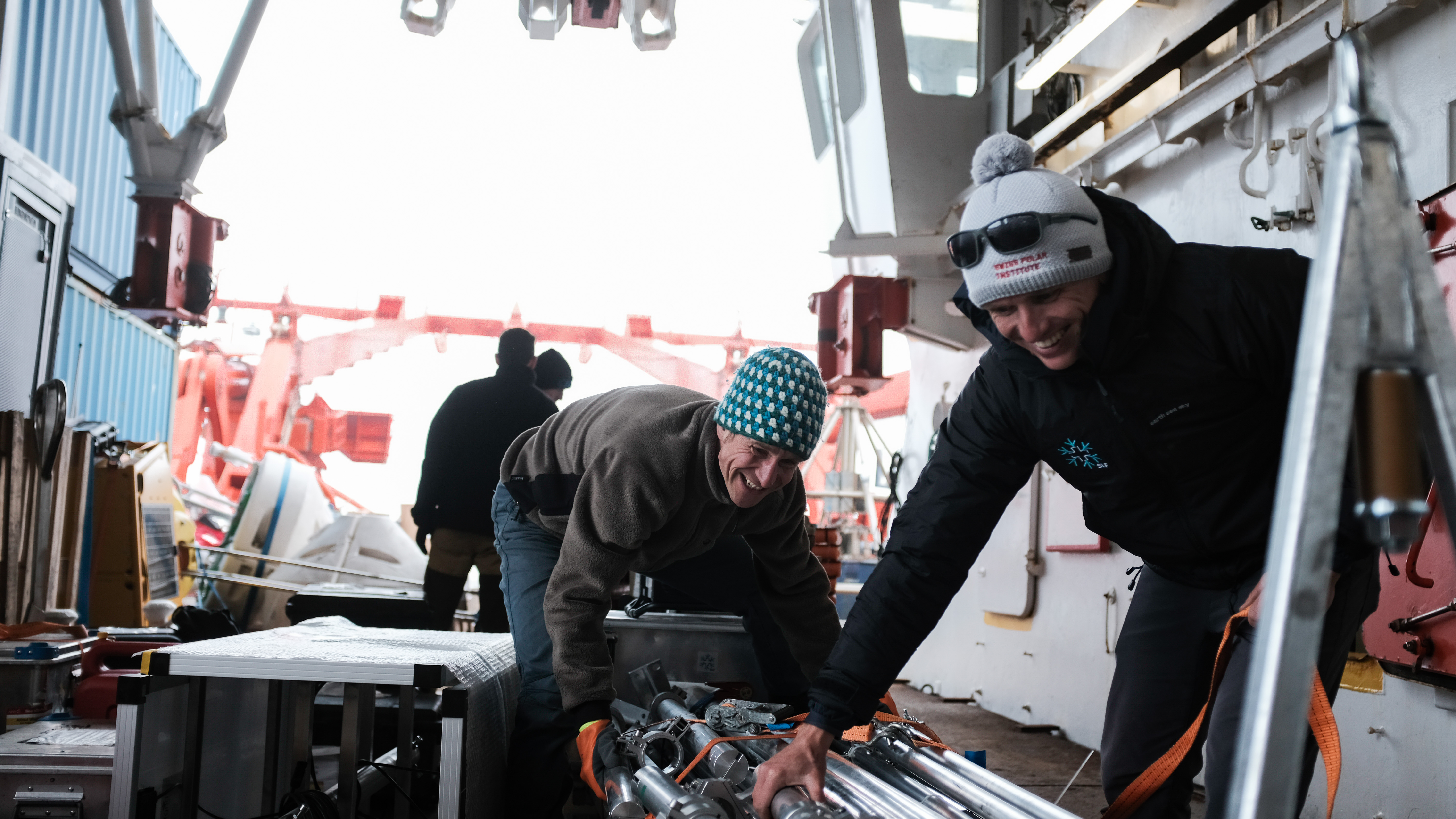
The heavy pieces of luggage for the measurements on the ice can be lifted onto the floe using a ship's crane. To do this, we pack the crates onto so-called Nansen sledges and secure everything with lashing straps. (Photo: Ruzica Dadic / SLF)

Image 6 of 12
Shortly after the first people were on the ice, the ship's horn sounded deafeningly. This means that there is a polar bear in the immediate vicinity and everyone must return to the ship immediately. Scientific measuring equipment is not a priority and must be left in place. (Photo: Coralie Elmaleh)


Image 8 of 12
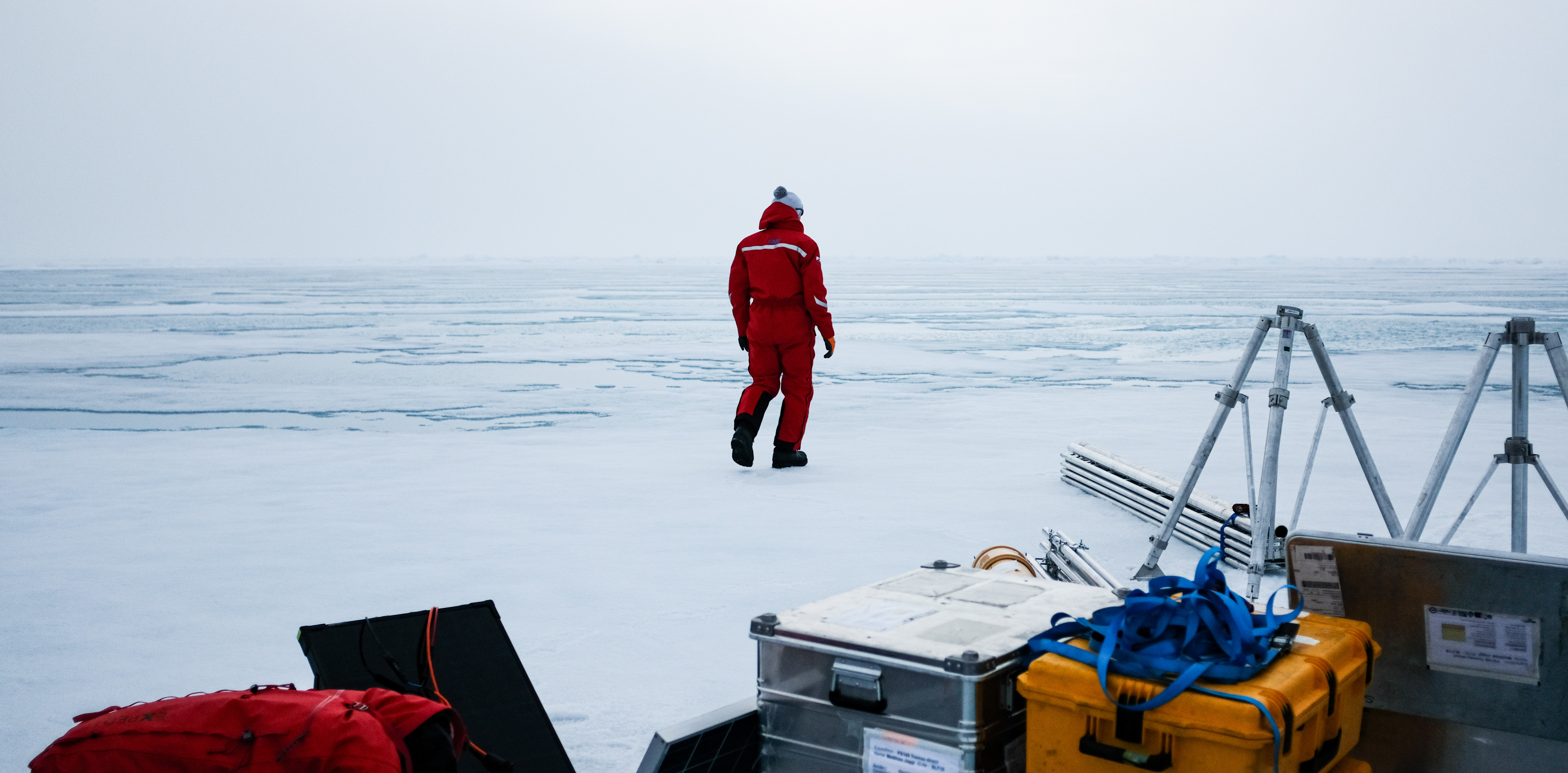
Exploring our measuring field. To measure the turbulent heat flows, we need the transition from a melt pond to ice. In addition, our measuring device must be set up in such a way that the wind blows in parallel. (Photo: Ruzica Dadic / SLF)

Image 9 of 12
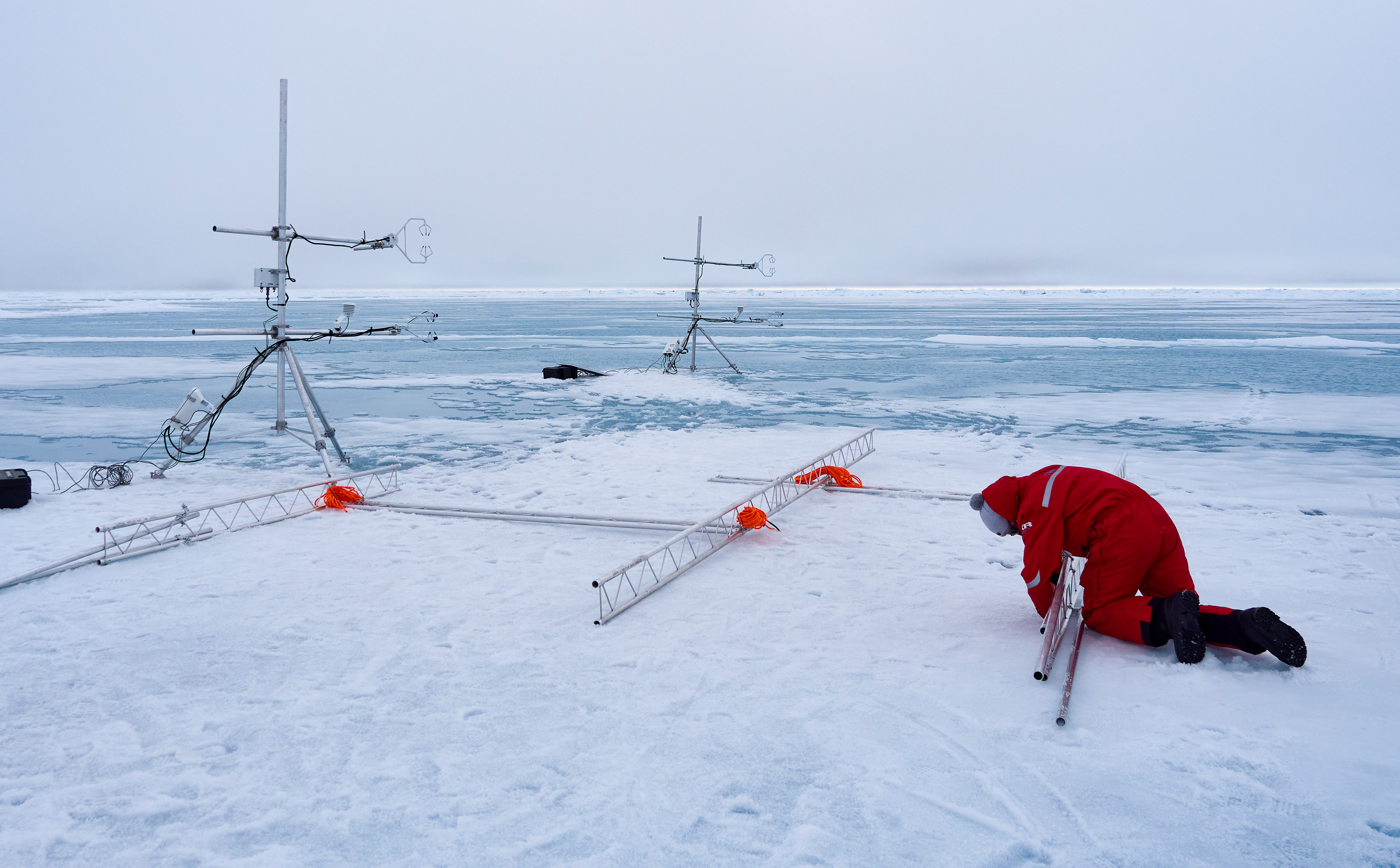
Assembly of the two wind measuring stations and the scaffolding for mounting the screen. (Photo: Matthias Jaggi / SLF)

Image 10 of 12
Completed measuring system consisting of a screen, thermal imaging camera protected in a tent and two wind measuring stations. (Photo: Michael Haugeneder / SLF)

Image 11 of 12
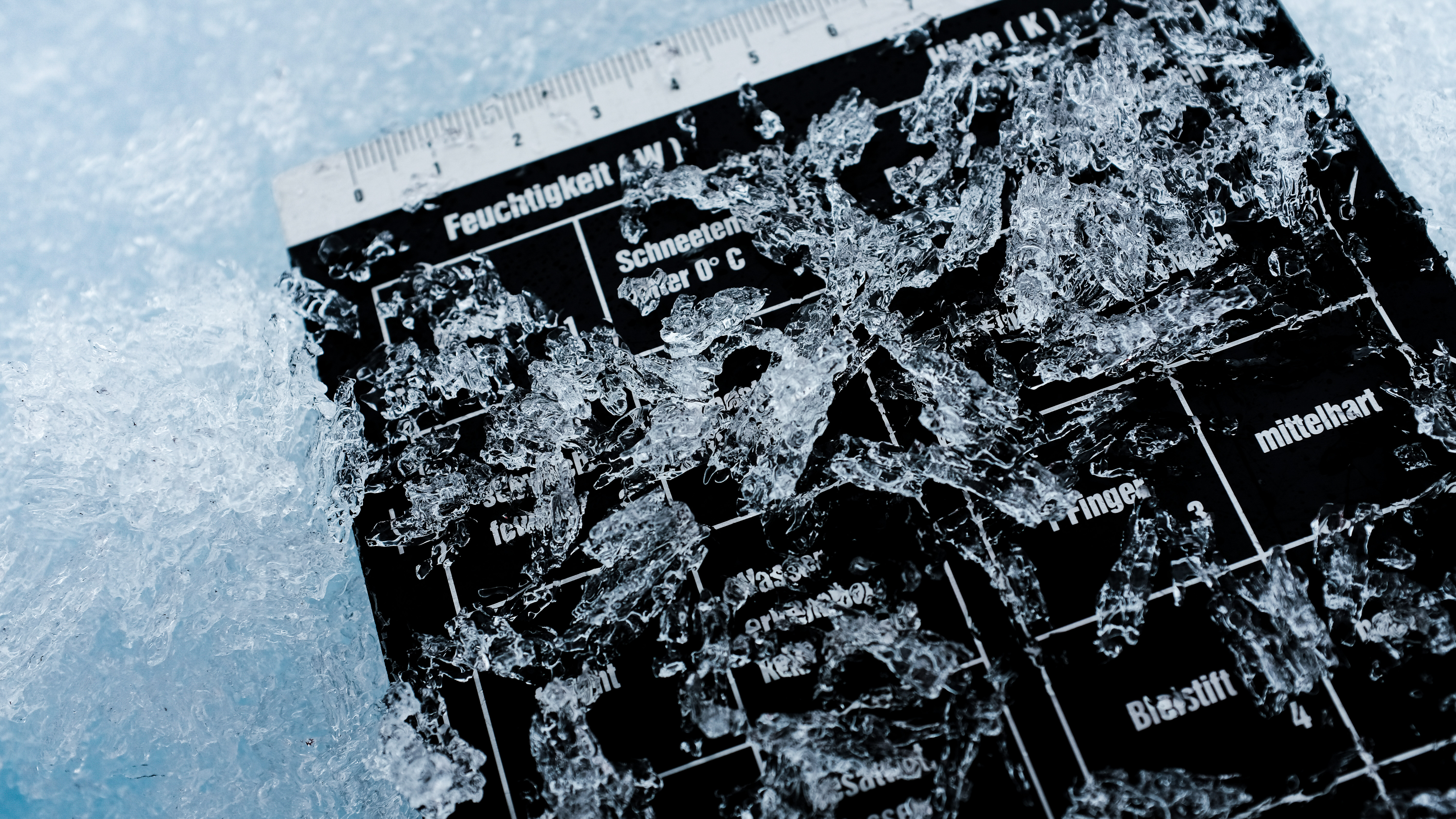
"Snow structure" consisting of the "Surface Scattering Layer" (SSL): Large, elongated ice crystals that have little to do with the snow we know in the Alps. It's not really snow at all, but melting sea ice. (Photo: Ruzica Dadic / SLF)

Image 12 of 12
Measuring the optical properties of the top layer of snow (SSL) using a measuring device developed at the SLF (SnowImager), which measures the reflected light in the near infrared. (Photo: Ruzica Dadic / SLF)
Links 
Copyright 
WSL and SLF provide image and sound material free of charge for use in press releases in connection with this media release. The use of this material in image, sound and/or video databases and the sale of the material by third parties is not permitted.