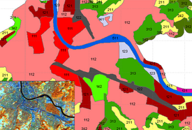
CORINE Switzerland
2010 - 2020
Cooperation Financing
Switzerland is participating in the pan European program of CORINE Land Cover / Land Use (CLC) mapping. The derivation of the national maps for CLC_2000, CLC_2006, CLC_2012 was supported and evaluated at WSL. We supported the whole process chain – satellite image archive, pre-processing of satellite images and ancillary data, technical consultancy and supervision for the external production as well as the final verification.
The newest CORINE data set for Switzerland - CLC 2018 and CLC Changes 2012 / 2018 - was generated completely at WSL within a EEA Service Contract.
WSL continues to support the FOEN in all technical details regarding Land Cover / Land Use and gives consultancy to future changes of data set such as CLC+ or EEA High Resolution Layers.
