
Grassland-use intensity maps for Switzerland
Steffen Boch
Christian Ginzler
Nica Huber
Tiziana Li Koch
Achilleas Psomas
Marcel Schwieder
2022 - 2027
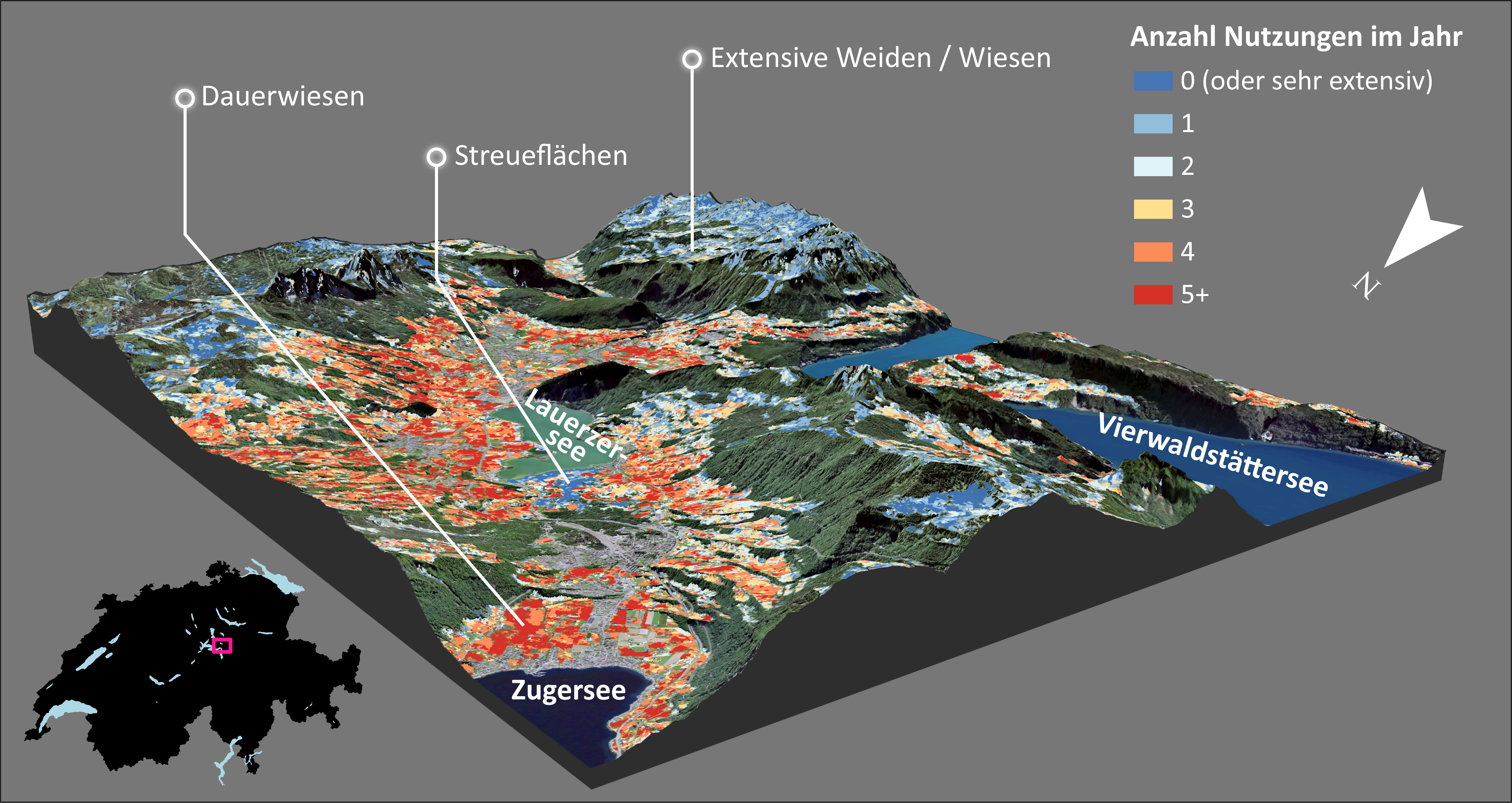
Land use intensity has a major impact on the biodiversity of our grasslands. However, it is time-consuming to measure it in detail over a large area. We have mapped the intensity of use across Switzerland using satellite imagery over several years, verified these maps and evaluated its potential for ecological applications.
Creation of nationwide maps
In this project, we use satellite time series to map grassland-use intensity (i.e. time and frequency of mowing/grazing) across Switzerland on an annual basis and investigate its potential for ecological applications and biodiversity research. We use freely available Sentinel-2 and Landsat-8 satellite images. The high temporal (about every 5 days) and spatial (10-30 m pixel size) resolution of the satellite images can be used to evaluate changes in vegetation using a vegetation index (here EVI; Enhanced Vegetation Index).
The maps can be downloaded at: https://www.doi.org/10.16904/envidat.428
Verification and potential for ecological applications
To assess the quality of the resulting maps, we verified the management events detected by the algorithm with daily information on grassland management from images of 82 publicly accessible webcams from all over Switzerland. Finally, we evaluated the potential of the generated maps for ecological applications using data on agricultural land use and the Swiss Biodiversity Monitoring (BDM).
