
Lessons learned 
Contents 
- Forest impact on flood formation
- Large dynamics, but hardly any significant longterm trends in the runoff
- Sediment transport in torrents: sensitive interplay between availability, morphology and discharge
- Runoff generation mechanisms
- Impact of enhanced nitrogen deposition on soils, plants and streams
Forest impact on flood formation 
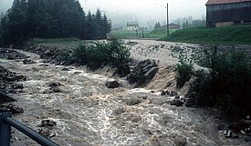
The long-term runoff measurements in three small catchments (~1km2) with different forest coverage (Vogelbach: >60% forest cover, Erlenbach: ~40% forest cover, Lümpenenbach: ~20% forest cover) have shown that the influence of the forest is clearly visible in the annual water balance. The fraction of evaporation increases with forest cover, and runoff decreases proportionately.
During large flood events, however, the forest here in the Alp Valley has no visible (dampening) effect on the flood peaks. This has to do in particular with the wet and very impermeable soils, which do not have sufficient additional storage for heavy precipitation.
Large dynamics, but hardly any significant longterm trends in the runoff 
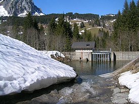
A comprehensive analysis of the longterm discharge measurements in the three torrent catchments has shown that the torrents exhibit a very large dynamic: the discharge during low water and flood peaks differs by four to five orders of magnitude.
Over the last 50 years, however, hardly any significant trends in discharge can be detected; neither in the annual mean values nor in individual months. Only in spring, as a result of changing snowmelt, can a general trend in discharge be observed over the last thirty years: an increase in March, and a decrease in May.
Exceptional (damaging) floods and droughts have occurred only sporadically in this period, so that no statements can be made as to whether such extreme events occur more frequently.
Sediment transport in torrents: sensitive interplay between availability, morphology and discharge 
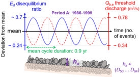
27 years of bedload transport measurements in the Erlenbach and several years of observations on the change of the elevation profile along a 550 m stream section have shown that bedload transport in a torrent is an interplay between sediment availability, streambed morphology and transport capacity, which moves around a sensitive equilibrium state. During a flood, bedload transport does not always begin at a constant critical discharge, but rather depending on prior events. These observations over such a long period of time with complementary measurement systems are worldwide unique.
Runoff generation mechanisms 
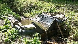
Ten years of spatial groundwater and runoff observations in the Studibach sub-catchment, including chemical, isotopic and connectivity measurements showed that the groundwater level dynamics depend on topography and that connectivity of the hillslopes to the streams changes seasonally and during events. The spatial variability in groundwater chemistry is larger than the temporal variability. There are four main types of groundwater chemistry within the Studibach: three are related to the landscape position, and the fourth is related to geology. The new water fractions during rainfall events are similar for different streams in the Alptal and are more influenced by event size than catchment characteristics.
Impact of enhanced nitrogen deposition on soils, plants and streams 
A 30-year experiment on small experimental plots (~1500 m2) has shown that increased nitrogen deposition leads to an accumulation of nitrogen in the soil, but with relatively little effect on plants in general and a slight improvement in tree growth in particular. In addition, nitrate leaching to streams increases, especially when trees are cut or tumble due to storm or insect infestation.
