SLF researchers have calculated light levels at the ground surface across Switzerland to within ten metres, in both open and forested areas. The model even simulates the shadows cast by individual trees.
- Nationwide light data: The SLF is making available the first high-resolution data on solar radiation at ground level.
- Key applications: The data provides a basis for snowmelt, climate and hydrological research.
- High precision: It takes account of terrain, mountains and even the shadows cast by individual trees.
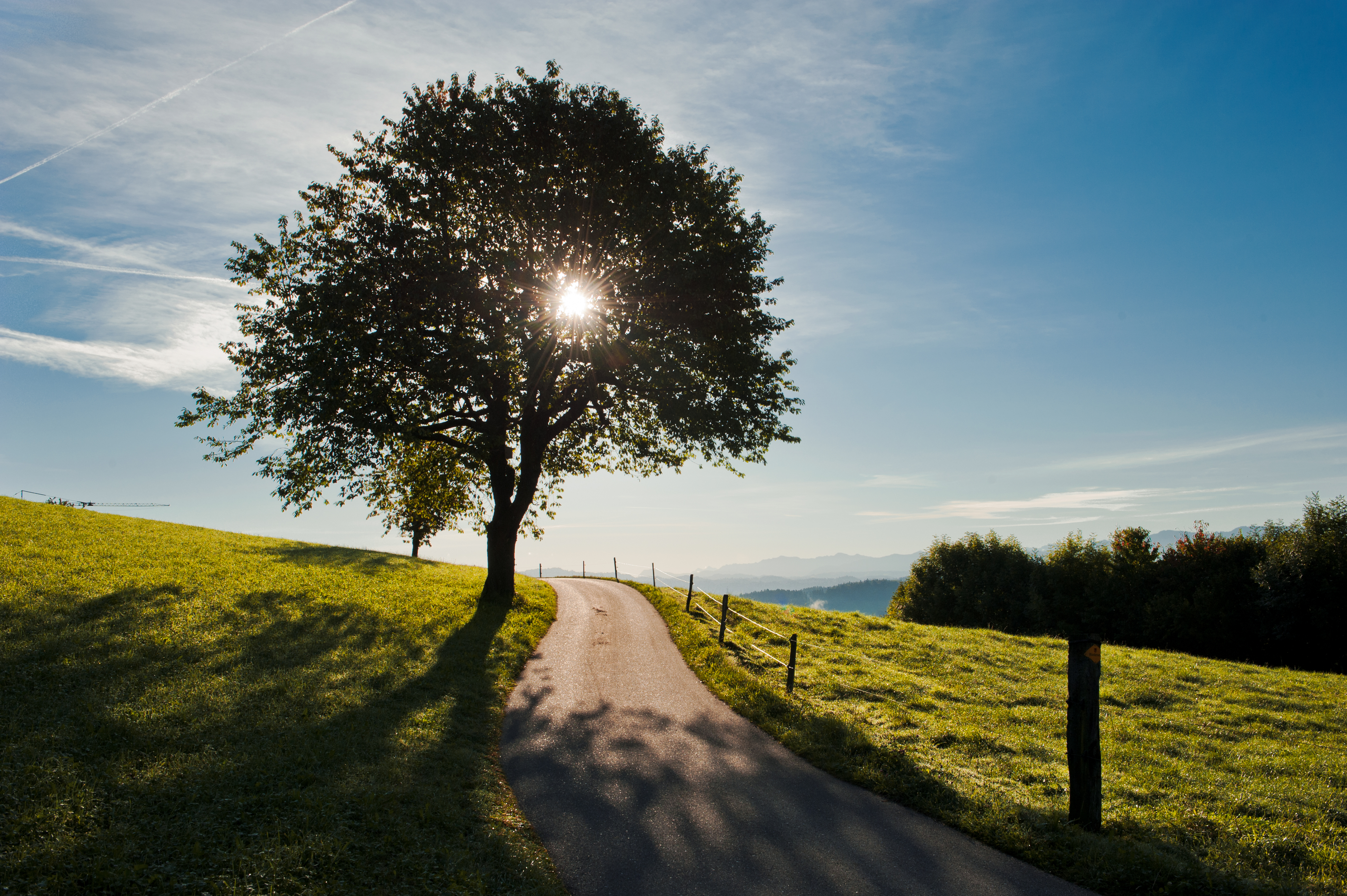
Light is energy. Light is snowmelt. Light is life. Light is so many things. This makes it all the more important to know when, where and how much light reaches the ground in Switzerland. It is precisely this data that researchers at the WSL Institute for Snow and Avalanche Research SLF are now making available to interested specialists on the EnviDat platform (see box). With a resolution of just ten metres, it becomes clear how much light reaches the ground, whether in the forest or in open terrain – hour by hour, day by day, over a full annual solar cycle. "This data is important for numerous research projects, from snow cover and snowmelt through to plant and animal microhabitats and forest microclimates," explains Clare Webster of the SLF's Snow Hydrology research group.
Important for snow research, flood protection and ecology 
Webster's team investigates how much snow falls, how much is stored in different parts of Switzerland, how snow cover changes over time and across different areas, and when and where it melts. This is important for many applications besides research, from natural hazards and flood warnings to hydropower and the leisure sector. "After all, across Switzerland as a whole, around a third of precipitation falls as snow," says Webster.
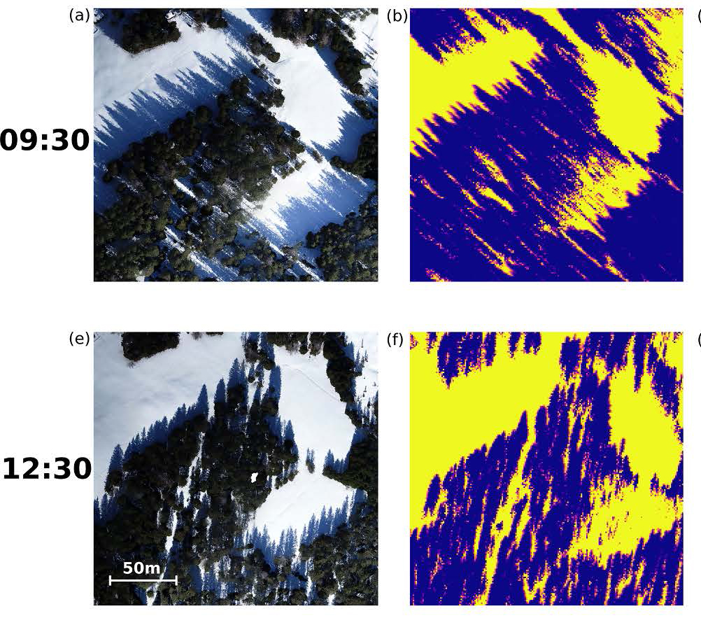
Among other factors, solar radiation plays a key role in accurate snowmelt forecasts. This is because in areas where sunlight reaches the snowpack early in the year, the white blanket of snow tends to disappear more quickly than on neighbouring shaded slopes. Both the terrain and the trees affect the amount of sunlight available, meaning that some areas receive many hours of sunlight, whilst others remain in the shade all day long. "Especially in forests, conditions can vary greatly from one metre to the next. And that's significant given that forests cover around a third of Switzerland," explains Webster.
What is … EnviDat?
EnviDat is the WSL data portal providing unified access to environmental monitoring and research data. The portal has the capability to store and publish datasets. Through the sharing of unique and high-value datasets worldwide, EnviDat fosters research and contributes to advancing environmental science.
Every single tree shadow counts 
To generate their results, the researchers used high-resolution data from the Federal Office of Topography swisstopo. "This allows us to calculate the shadow cast by every hill and even every individual tree in Switzerland," says Webster. A particular challenge was factoring in the structure of tree crowns, which varies depending on the species. This is especially relevant for deciduous trees and larches, as they shed their leaves in autumn, allowing more light to reach the ground until spring.
The data has already also been incorporated into WSL's latest research findings. "We've used it to carry out detailed snow simulations for Swiss mountain forests and to show how forest influences snow cover dynamics in different ways, depending on elevation, terrain and weather," says Webster by way of example. The researchers also used an earlier version of the dataset to demonstrate the dominant role of solar radiation in shaping forest microclimates in Switzerland.
Links 
- To the study Hourly potential light availability maps at 10 m resolution over Switzerland
- Light on the ground in Switzerland: map
- To the study on how forests influence snow cover development differently depending on altitude, terrain and weather: How montane forests shape snow cover dynamic across the central European Alps
- To the study on the role of solar radiation for the forest microclimate in Switzerland
- To the study Using just a canopy height model to obtain lidar-level accuracy in 3D forest canopy shortwave transmissivity estimates
- Snow hydrology research group at the SLF
- Remote Sensing Research Group at the WSL
Contact 
Copyright 
WSL and SLF provide image and sound material free of charge for use in the context of press contributions in connection with this media release. The transfer of this material to image, sound and/or video databases and the sale of the material by third parties are not permitted.