Differentiation of fractures and rock mass deformation in clay rocks by Machine Learning
2023 - 2027
Accurately detecting and differentiating discontinuities in clay rocks is essential. These features, emerging from natural and artificial processes, can indicate fractures or the deformation of rock masses. Identifying different discontinuities is crucial for ensuring the stability and safety of structures like tunnels and foundations, as well as for a comprehensive understanding of hydrogeological dynamics. However, distinguishing various discontinuities poses a significant challenge due to the ambiguity of class-defining features and the complexity of large datasets, which vary in resolution and quality from 2D to 3D. This complexity leads to confusion and an overwhelming workload for human experts.
The rapid advancement in AI, particularly in image classification and segmentation, offers more precise and efficient approaches. Developing and employing state-of-the-art machine learning methods allows for uncovering more detailed features from the geological data, thereby enhancing the ability to distinguish between different types of discontinuities. The Mont Teri Lab provides a rich array of geological structure representations, which can serve as the foundation for machine learning-driven analysis.
The ML project aims at:
- Detecting and differentiating various kinds of natural and artificial discontinuities from existing and new datasets in clay shales using ML tools.
- Understanding the optimal data quality standards necessary for effective ML analysis. Developing a robust methodology that efficiently manages and processes these varying data types to ensure accurate and reliable outcomes.
- Developing a workflow/application that a “standard” user can operate.
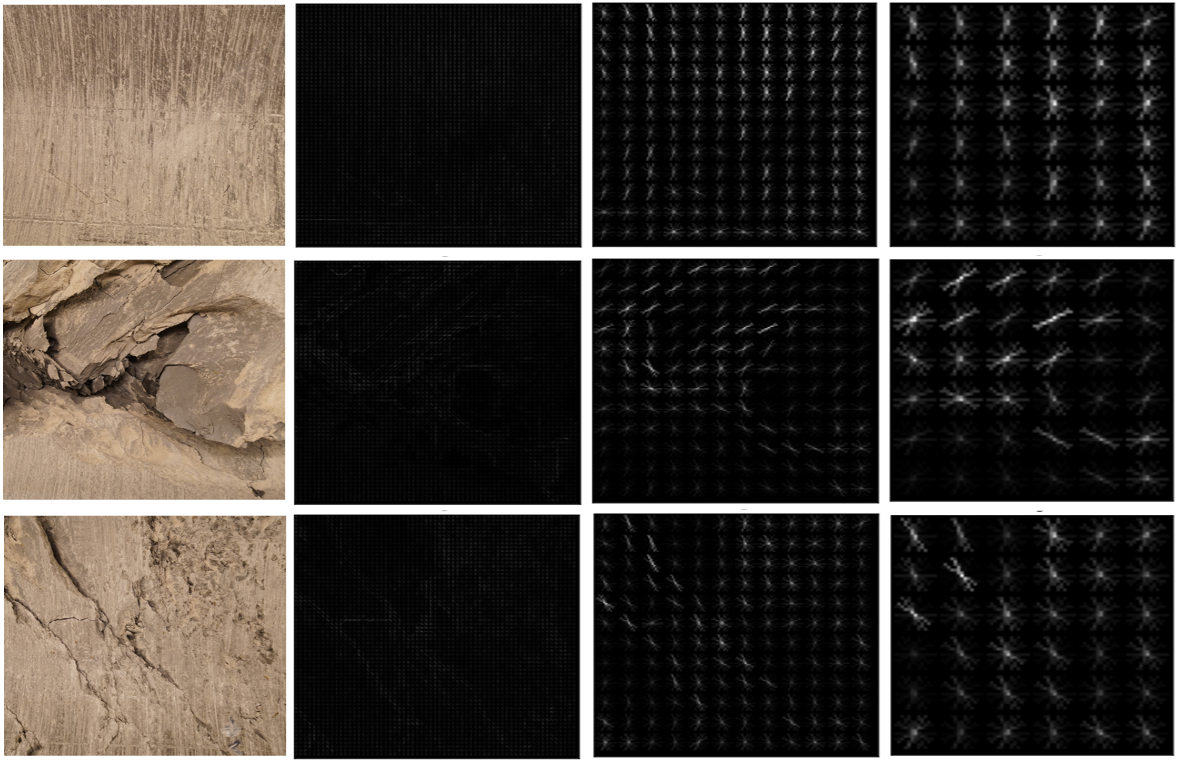
This project leverages advanced machine learning methods to assist geological analysis. For instance, Vision Transformer (ViT) has recently emerged as a robust alternative to Convolutional Neural Networks (CNNs) which are state-of-the-art in many computer vision tasks, offering enhanced computational efficiency and accuracy. Additionally, the application of explainable AI techniques enables us to identify and understand the key features that significantly influence the classification decisions made by the machine learning model. Furthermore, the incorporation of time-series analysis can offer valuable insights into the temporal evolution of these geological features and predict future changes in rock mass behaviour.
Figure 1 shows an example of the features extracted from the ML process.
To achieve these objectives, a diverse team of experts has been formed, bringing together specialized knowledge from various disciplines. This team comprises professionals in the following areas:
- Engineering geology.
- Remote sensing.
- Geodata management.
- Machine learning, AI.