High-resolution soil maps for the Swiss forest
2019 - 2021
Cooperation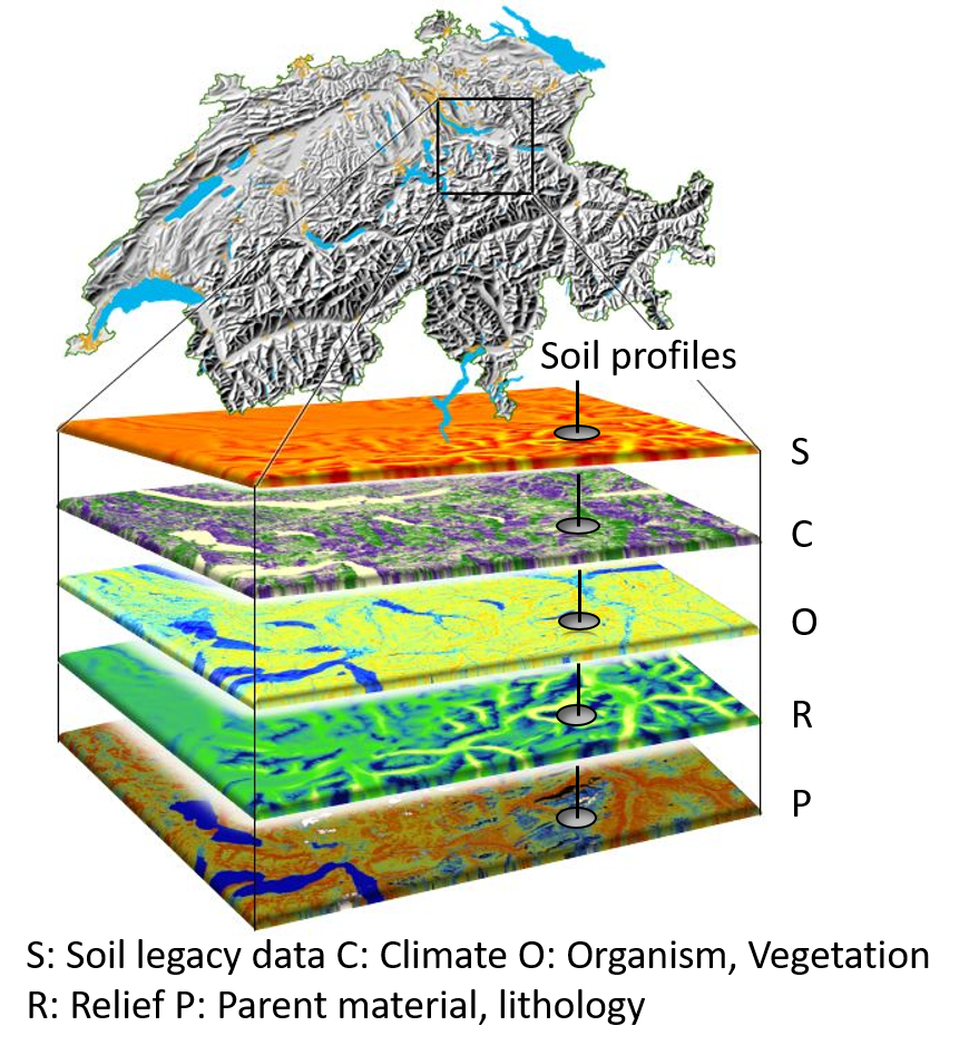
Forest soils play an important role in providing ecosystem services such as regulating the water cycle, influencing carbon transfer, nutrient uptake and release, and providing habitats for a wide range of organisms. Information on soil properties is important to assess and quantify these ecosystem services. However, this information is sparse or does not cover the entire extent of the Swiss forest.
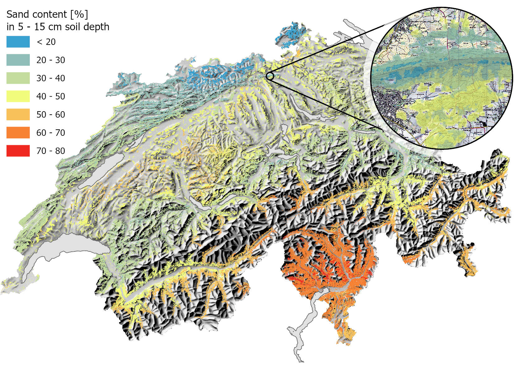
The aim of the project is to produce high-resolution soil maps for the Swiss forest. The soil maps, which are based on about 2000 soil profiles, contain chemical and physical properties such as pH, texture or carbon content for various soil depths. The soil depth itself is also modelled.
The modelling of soil properties is based on the principle of «digital soil mapping». This involves linking soil profiles with soil forming factors using statistical models. This statistical relationship can then be used to predict soil properties for the entire Swiss forest.
Soil forming factors are derived from a comprehensive set of spatially continuous covariates containing information on topography, vegetation, climate and geology.
The terrain attributes, derived from digital terrain models and smoothed by a range of convolution filters, reflect the influence of different spatial scales. Information on vegetation is derived from high-resolution satellite images and LIDAR point clouds.
Example of a soil map 