Landscape monitoring requires appropriate methods to record land and soil use and to analyse their development. We apply and enhance existing methods. For example, we developed a method to accurately observe small landscape changes over a relatively short period of time - in all three dimensions.
Contents 
Thus, not only can we record the type of land use, for example the extent of the forest surface area, but also the surface area and height of the trees. In this way, we are improving the environmental monitoring data bases.
Three-dimensional measurements have been made possible with the aid of «Airborne Laser Scanning» (ALS) which measures the distances to the surface from an airplane. With vegetation such as trees, the laser beams partially penetrate through the actual surface and reach the underlying soil. The surface area and terrain can be modelled on the basis of these data.
Close Monitoring of Temporal and Spatial Landscape Development 
The cost of a countrywide survey using ALS is high; therefore, regular updating of the data can be carried out only to a limited extent. We have developed a more efficient method for updating the 3D landscape data. It is based on digital stereoscopic images which are routinely taken by the Swiss Federal Office of Topography, swisstopo. Since 2005, these stereoscopic images, which feature a high degree of spatial resolution, have been recorded with the "ADS80" digital sensor. As swisstopo repeats the recordings every three years, the resolution of the data is both spatially and temporally high.
Estimate forest resources or glacier thickness 
Within the context of the National Forest Inventory (NFI), we have applied this data on forest resources. We have used a data processing procedure for calculating a comprehensive nationwide digital surface model (DSM) from the ADS80 stereoscopic images. DSMs now constitute an important data basis for assessing natural resources on a large scale with a high spatial resolution. In forests, for example, the height of the trees and the stocks accounts for a substantial part of the existing wood volume and biomass.
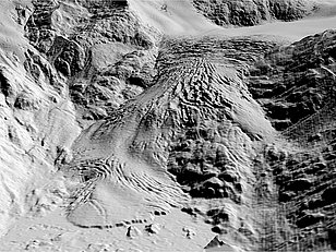
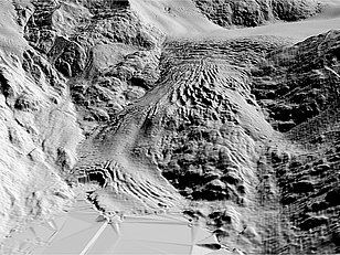
Our method makes it possible to observe even small changes in the forest and other types of land cover over a relatively short period of time. Because the 3D calculations for Switzerland are carried out comprehensively, it is also possible to detect changes in the high mountains, e.g. in glaciers.


Vegetation heights on map.geo.admin.ch 
Thanks to the Vegetation Height Model (NFI), vegetation heights throughout Switzerland are now integrated into swisstopo's online maps (map.geo.admin.ch). The model is based on the digital surface model, which measures the height (above sea level) of all objects, minus the terrain model swissALTI3D by swisstopo. Since the buildings can be hidden, the vegetation height model also shows the height of vegetation in cities, making parks or forest areas destroyed by hurricane Lothar in 1999 recognisable.
With the vegetation height model, scientists or forest managers can answer specific questions, whether on the shading of water bodies or on the homogeneity of certain forest areas. The data are freely available and can be ordered via the data portal Envidat or directly from Christian Ginzler.
Vegetation elevation model on map.geo.admin.ch: The above average height of the trees in the Sihlwald natural forest reserve is clearly visible. (Source: swisstopo)
