13.03.2024 | Marco Conedera, Jeremy Feusi, Boris Pezzatti, Patrik Krebs | WSL News
Climate change influences how often and how intensively forests in Switzerland could burn in the future. However, changes in land-use play a major role therein. Forest fire specialists at the Swiss Federal Institute for Forest, Snow, and Landscape Research WSL in Cadenazzo have demonstrated this interplay in a new study.
The statistics on the fire area south of the Alps show a regular and continuous downward trend since the 1980s. This development is mainly due to increasingly effective prevention and better organization of firefighting. This includes the specific training of firefighters for forest fires, the timely and systematic use of helicopters, and the increasing availability of firefighting infrastructure such as water extraction points.
What favors large fires 
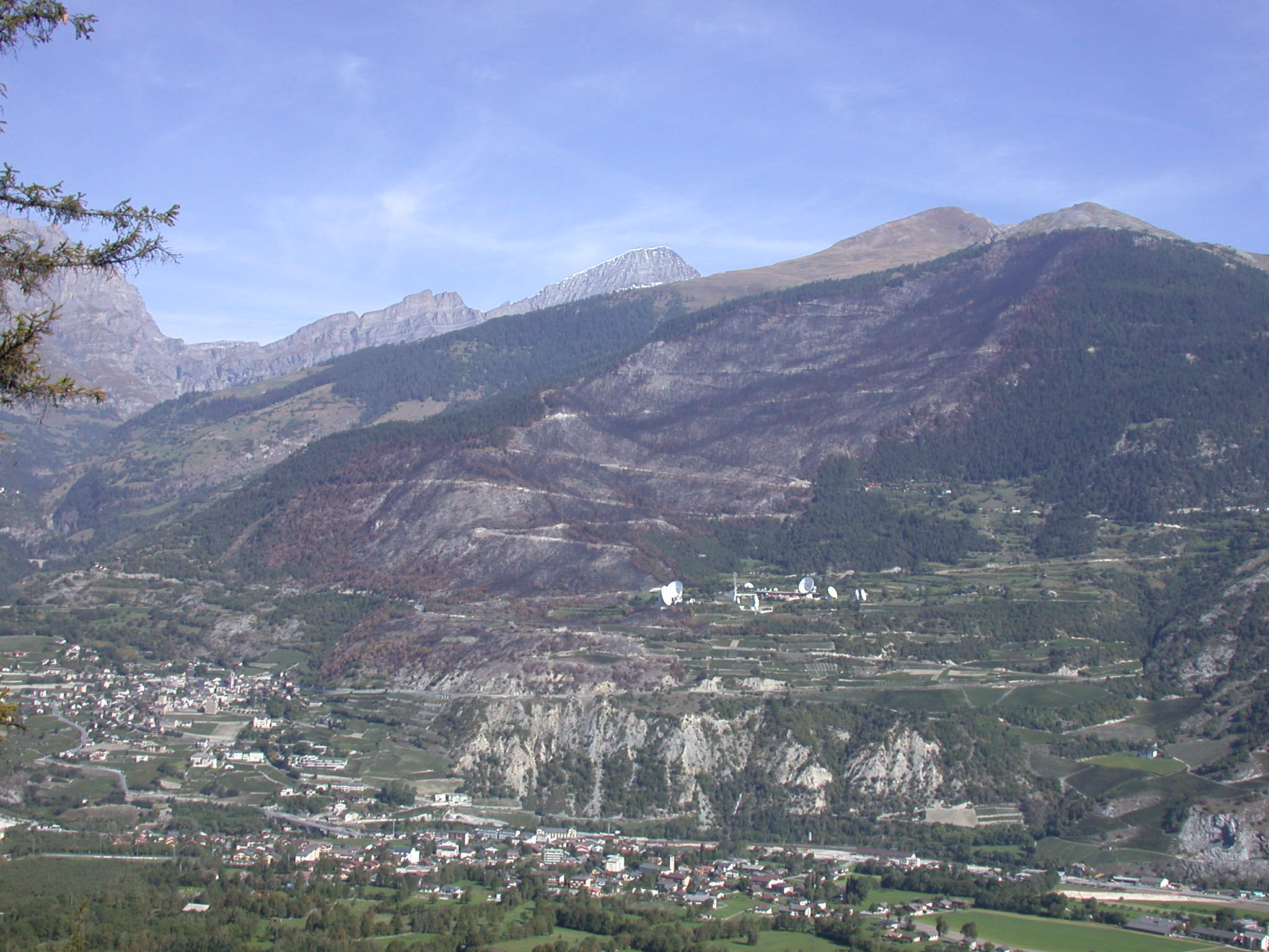
Nevertheless, there are still occasional large fires, i.e. high-intensity fires that spread over large areas after escaping the fire brigade's initial attempts to control them. These fires usually occur in extreme weather situations such as prolonged droughts combined with strong winds for multiple days, and on steep and densely wooded slopes. Examples include the fires in Leuk in Valais in 2003 (Fig. 1), Mesocco in 2016, and on Monte Gambarogno in 2022. Under these conditions, the fire creates rising thermals that make it very difficult or even impossible for firefighters to reach the fire front and fight it.
As climate change progresses, extreme weather situations are expected to increase in the future, favoring the development of very intense fires. Under these conditions, the likelihood of the fire getting out of control and spreading over large areas depends heavily on the rate of spread and the intensity of the flame front. The WSL experts reckon that under these circumstances, steep slopes and continuous forest cover, which is associated with a lot of combustible material, could make fighting forest fires much more difficult.
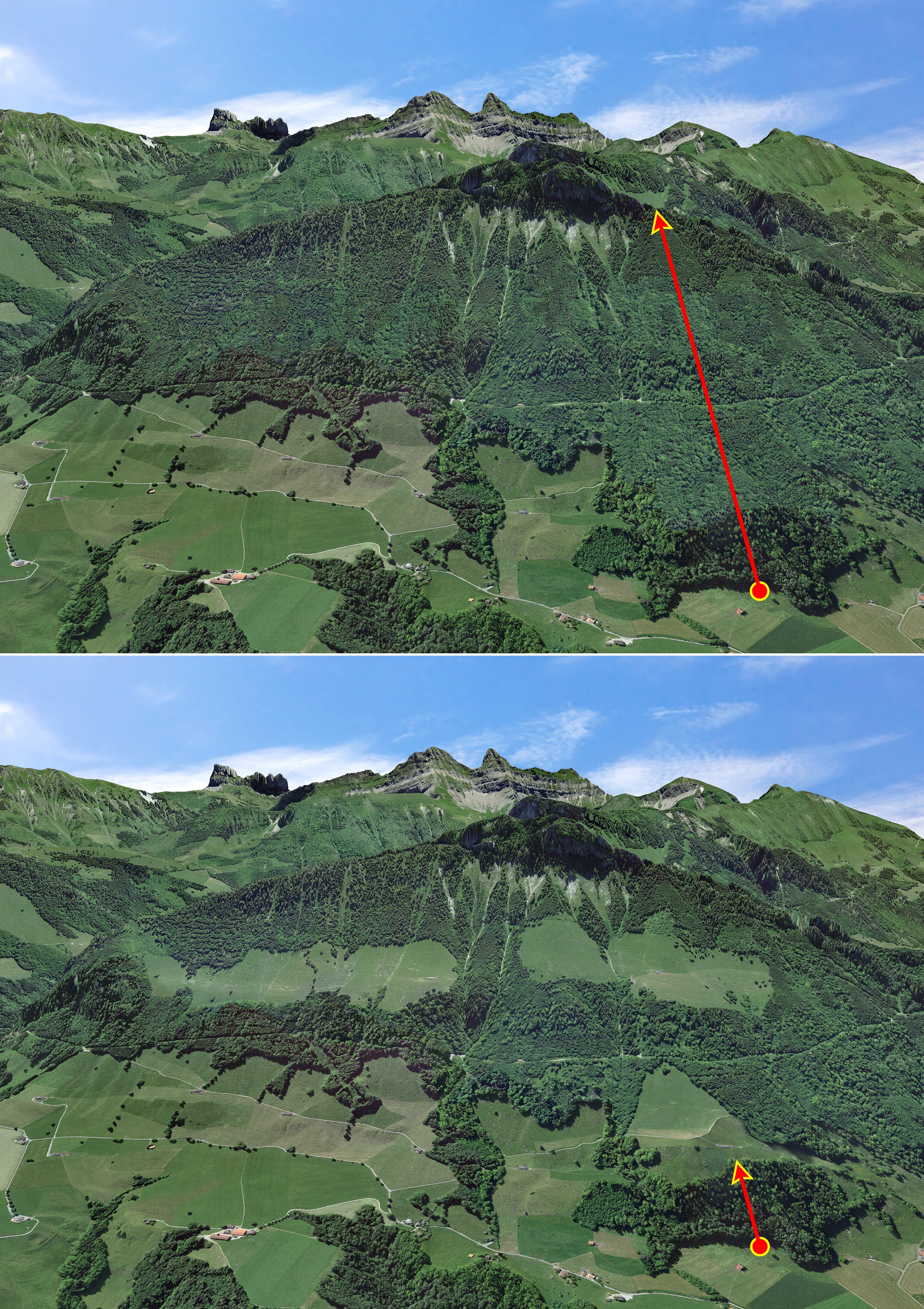
To test this hypothesis, they have developed an algorithm that generates the possible propagation paths of a flame front based on the slope of the terrain and the distribution of forest cover. The program provides for an interruption of the flame front where the fire encounters open areas such as pastures, and arable land, or flat areas.
Slope inclination and landscape design are decisive 
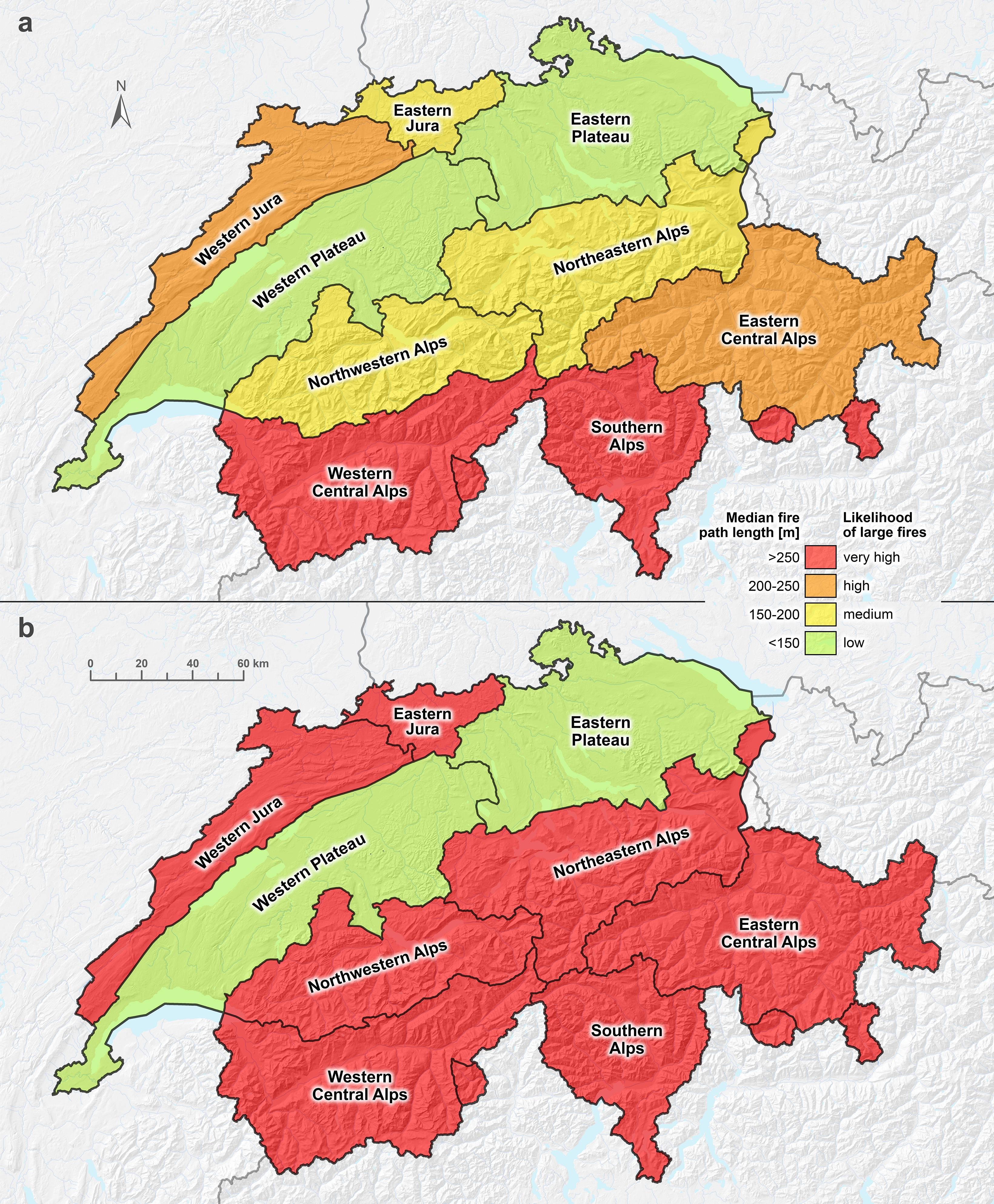
The research team first applied the algorithm to the entire national territory of Switzerland, taking into account the current extent of the forest area. In a second step, the researchers repeated the process with a hypothetical extreme scenario: the complete abandonment of agricultural activities and the associated complete afforestation of the entire territory up to an altitude of 2500 metres above sea level.
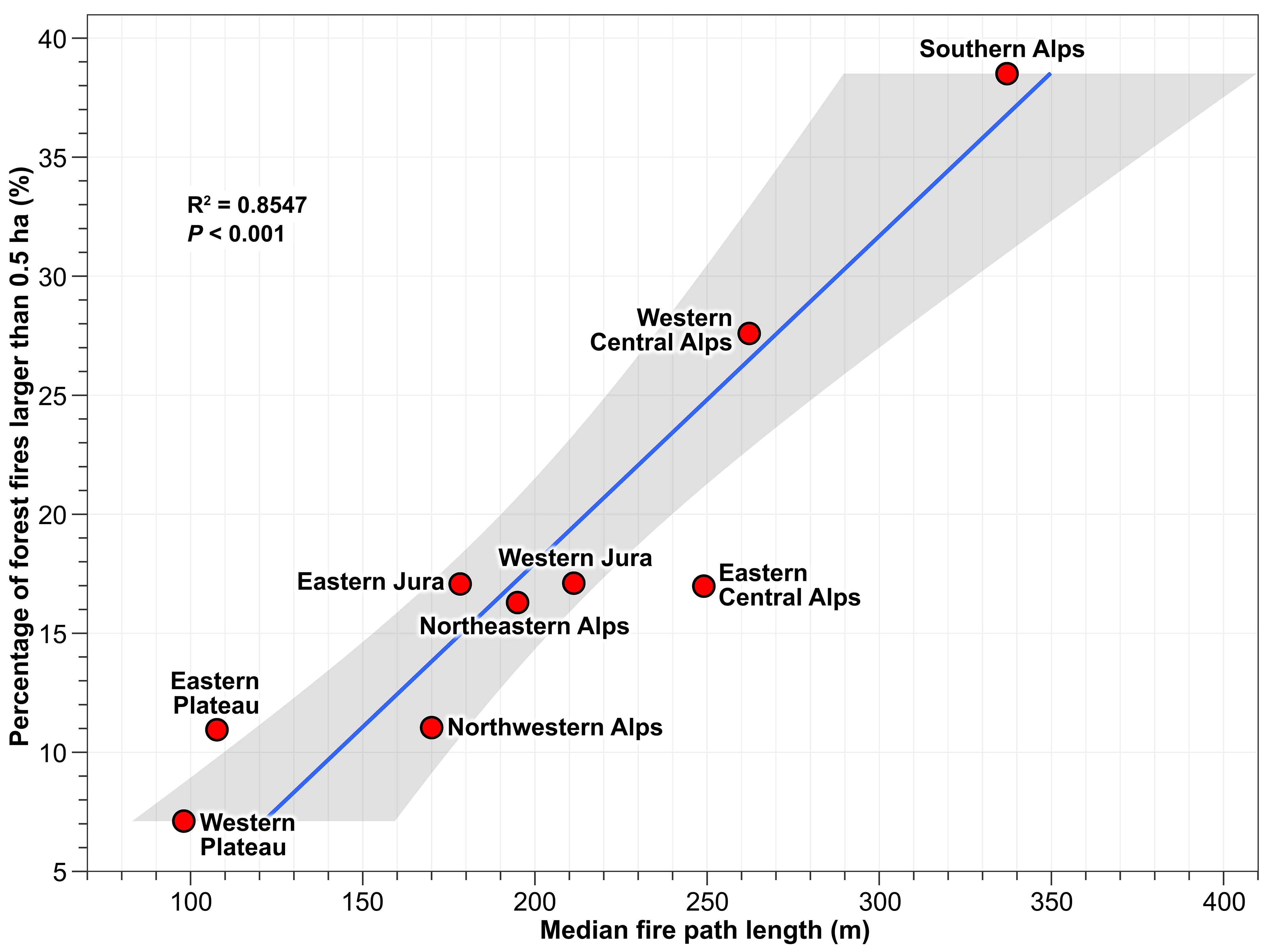
Finally, they divided Switzerland into nine biogeographical regions and compared the length of the possible propagation paths of the flame front obtained with the occurrence of the largest fires of the last 30 years in the respective regions. This data is taken from the Swissfire database, which the WSL operates for the federal government.
As Figure 2 shows, there is a clear correlation between the median fire path length and the percentage of forest fires of a certain size. This applies particularly to the regions most affected by the abandonment of traditional agricultural activities and the related transition to forest area. These are primarily the western central Alps (Valais) and southern Switzerland.
According to the researchers, this clearly shows that the probability of being affected by major fires would increase significantly throughout Switzerland (with the exception of the Central Plateau) if agricultural use were to be abandoned and a complete transition to forestation were to occur (Fig. 3 and Fig. 4).
This result emphasizes the great importance of agricultural land-use. It is not only about preserving landscape diversity, which is ecological and cultural wealth, but also about preserving open spaces, which are the most effective firebreaks on mountain slopes.
Always up to date: Subscribe to the WSL Newsletter
Contacts 
Publication 
Conedera, M., Feusi, J., Pezzatti, G. B., & Krebs, P. (2024). Linking the future likelihood of large fires to occur on mountain slopes with fuel connectivity and topography
Copyright 
WSL and SLF provide image and sound material free of charge for use in the context of press contributions in connection with this media release. The transfer of this material to image, sound and/or video databases and the sale of the material by third parties are not permitted.