15.09.2022 | Christine Huovinen | News SLF
The SLF's Risk and Resilience research group is developing resources and software tools to better assess the risk of natural hazards and the costs and benefits of protective measures.
The SLF showcases the research groups of the Climate Change, Extremes and Natural Hazards in Alpine Regions Research Centre CERC, in no particular order. Founded in 2021, the CERC is sponsored by the Canton of Grisons and the Swiss Federal Institute for Forest, Snow and Landscape Research WSL and is supported by ETH Zurich. It is part of the SLF in Davos.
"My vision is an interactive tool that shows the risk of alpine natural hazards at any given location on a map – today and in the future," says Michael Bründl, who leads the SLF Risk and Resilience research group, part of the CERC. This is a vision that is not altogether easy to implement. Just forecasting where and when avalanches, rockfalls or debris flows will occur is a science in itself. If you also want to calculate the risk, you have to link the probability of a natural hazard occurring – such as an avalanche being triggered – to its consequences, e.g. the severity of the damage when an avalanche hits a building or a skier.
Using limited resources wisely
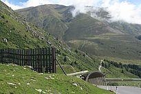
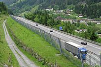
As the call for protection against natural hazards gets louder – especially as a result of climate change – such risk assessments become essential; they allow limited financial and human resources to be utilized as efficiently as possible to protect life and property. There are already valuable tools available for this purpose. For example, the online calculation tool EconoMe, maintained by Bründl's group, analyses the cost-benefit ratio of various protective measures – whether, for example, for a road at risk of avalanches it would be better to build a supporting structure in the starting zone or a snow shed over the road.
Instrument for dialogue on protective measures
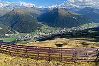
The calculation methodology on which EconoMe is based is now also being used by Bründl's group to bring his vision a step closer: on behalf of the Office for Forest and Natural Hazards of the Canton of Grisons, researchers are currently developing a user-friendly, interactive risk indicator map for avalanches as part of a pilot study in the Davos landscape. The results fill Bründl with confidence: "I believe that such maps can be implemented for larger areas and other natural hazards as well as for future climate and social scenarios. This would give us an important tool to enter into dialogue with the public and the authorities about sensible protective measures."
Copyright
WSL and SLF provide the artwork for imaging of press articles relating to this media release for free. Transferring and saving the images in image databases and saving of images by third parties is not allowed.


