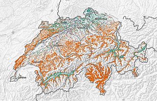
Where do ecologically valuable or rare tree species, such as oaks or yews, grow? Where do bilberries (which are good capercaillie habitats) flourish? The Swiss Federal Institute for Forest, Snow and Landscape Research (WSL) has developed the first high-resolution online maps that can provide detailed answers to such questions for 56 woody species found in Swiss forests.
The maps are based on data from the WSL National Forest Inventory NFI, which records all trees and shrubs on the 6,500 NFI sample plots. However, these sample plots alone cannot reveal definitive information on the occurrence of specific trees and shrubs for all Swiss forests. To fill in the gaps, the researchers used a statistical calculation model to link the NFI data with climate, soil property and topographic maps covering all of Switzerland, making it possible to calculate the forest sites suitable for each woody species and showing the likelihood of occurrence on a map with a resolution of 25 x 25 metres.
The researchers have tested the model extensively by comparing it with observations. With a total of 56 of the 150 species recorded by the NFI, the predictions were good enough to produce maps, which are now available on a freely accessible WebGIS portal. To avoid any misunderstanding: "The map shows the potential, rather than the actual, occurrence of a species," explains project manager Andri Baltensweiler from the WSL GIS research group.
Habitats for bees and capercaillies
"The Switzerland-wide distribution map has been warmly welcomed by nature conservation experts, foresters and ecologists alike," says Baltensweiler. "Until now, information on the potential occurrence of tree species was only available for a handful of cantons, with each canton recording data differently." Researchers and nature conservationists have already made use of the maps:
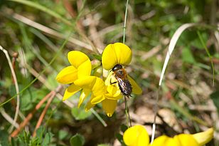
- A research team from ETH Zurich used them to investigate suitable nesting sites for the pinewood mason bee (Osmia uncinata), which lives exclusively in the bark of old Scots pines. The distribution of these trees is therefore vital to the conservation of this bee species.
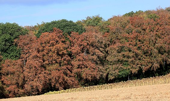
- WSL researchers used the beech distribution map combined with satellite data to record the damage to these trees caused by the 2018 drought.
- The leaders of the 'Ökologische Infrastruktur Mittelland (ÖIM)' project (Ecological Infrastructure of the Swiss Plateau), which aims to link natural and near-natural areas, used the maps to identify ecologically important forest areas.
Further possible uses include the following:
- The distribution of bilberry bushes can indicate potential capercaillie habitats that need to be protected. A WSL project has shown that in the Jura and Alpine foothills, this rare bird is most likely to be found in the vicinity of bilberries.
- The distribution of birch trees, for example, may be important for people with allergies, while for foresters it may be useful to find out the occurrence of species that should be particularly promoted.
Thanks to light detection and ranging (LiDAR), the model can now also fully incorporate the forest structure. Using laser light, this technology can display the forest structure in 3D. "You now know whether the forest in each cell is high or low, dense or sparse," explains Baltensweiler. "This is especially helpful for making predictions about the distribution of light-loving trees or shrubs."
Contact
Links
- Potential distribution of the most common woody plants in Swiss forests:
https://www.lfi.ch/produkte/mogli/mogli.php - National Forest Inventory NFI
Publications
Copyright
WSL and SLF provide the artwork for imaging of press articles relating to this media release for free. Transferring and saving the images in image databases and saving of images by third parties is not allowed.


