Regional landslide early warning: Pilot study Napf
2020 - 2034
Cooperation Financing
In Switzerland, shallow landslide frequently cause damage to infrastructure and put lifes at risk. Mostly, they are triggered by intense rainfall or snow melt events and often occur suddenly and over large areas. Particularly due to the short interval time between activation and failure, reliable early warning of shallow landslides is crucial.
In this project, the potential of various elements of regional landslide early warning is assessed. The applications are tested within a pilot early warning system in the Napf region.
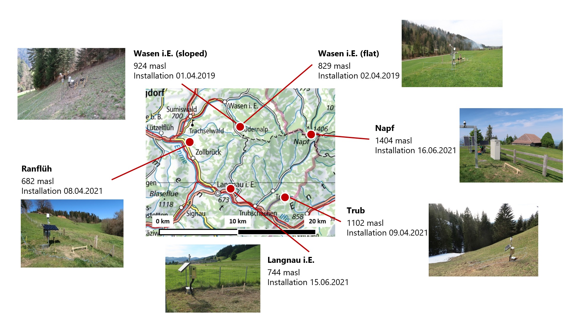
Added value of soil wetness measurements (Lead: Adrian Wicki, WSL)
The added value of soil moisture measurements for landslide early warning lies primarily in the characterization of the antecedent wetness conditions. To test the potential of in-situ soil wetness measurements for regional landslide early warning, four soil wetness monitoring sites were installed in the Napf area beneath two already existing sites. At the total six sites, the volumetric soil moisture and the matric potential are measured at four measurement depths (14, 30, 50 and 100 cm). The main subjects of study are to characterize the representativeness of point measurements for regional landslide predictions and the added value of soil wetness measurements for the parametrization of soil hydrological models.
Report (in german) describing the locations and soil properties in detail
Hydromechanical modelling (Lead: Peter Lehmann, ETH Zürich)
The hydromechanical landslide model STEP-TRAMM is used to deterministically simulate the timing, location and volume of shallow landslides. The model calculates the progressive weakening of soil columns and is based on the fiber bundle model. In this study, the model is applied at large scale in the entire study area. The focus lies on assessing the effects of changing the modelling scales and of better determining the boundary conditions on the the skill of the landslide forecasts.